Forecasting
The purpose of forecasting works is to identify, within an area of interest, potentially promising sites according to the interpretation of sattelite imagery data, characterized by a set of criteria indicating the possibility of localizing a mineral resource. According to experience, the area of such sites is from 5 to 20% of the study area. Outlined areas are heterogeneous in terms of the content of favorable cosmogeological signs of ore prospect and are ranked by priority for further prospecting.
In addition to the contours of promising areas, the customer receives an array of additional information about the structure and features of the area of work, often not reflected in the available geological and other specialized maps.
Thus, the client has the ability to localize exploration operations done on the ground, taking into account the results of a comprehensive forecasting studies. That, in turn, optimizes costs and significantly reduces the cost of prospecting.
The main mineral resouces we work with:
- copper
- iron
- precious metals (gold, silver, platinoids)
- diamonds
- building and decorative stone
- gems
- underground waters, including thermal
- uranium
- oil and gas
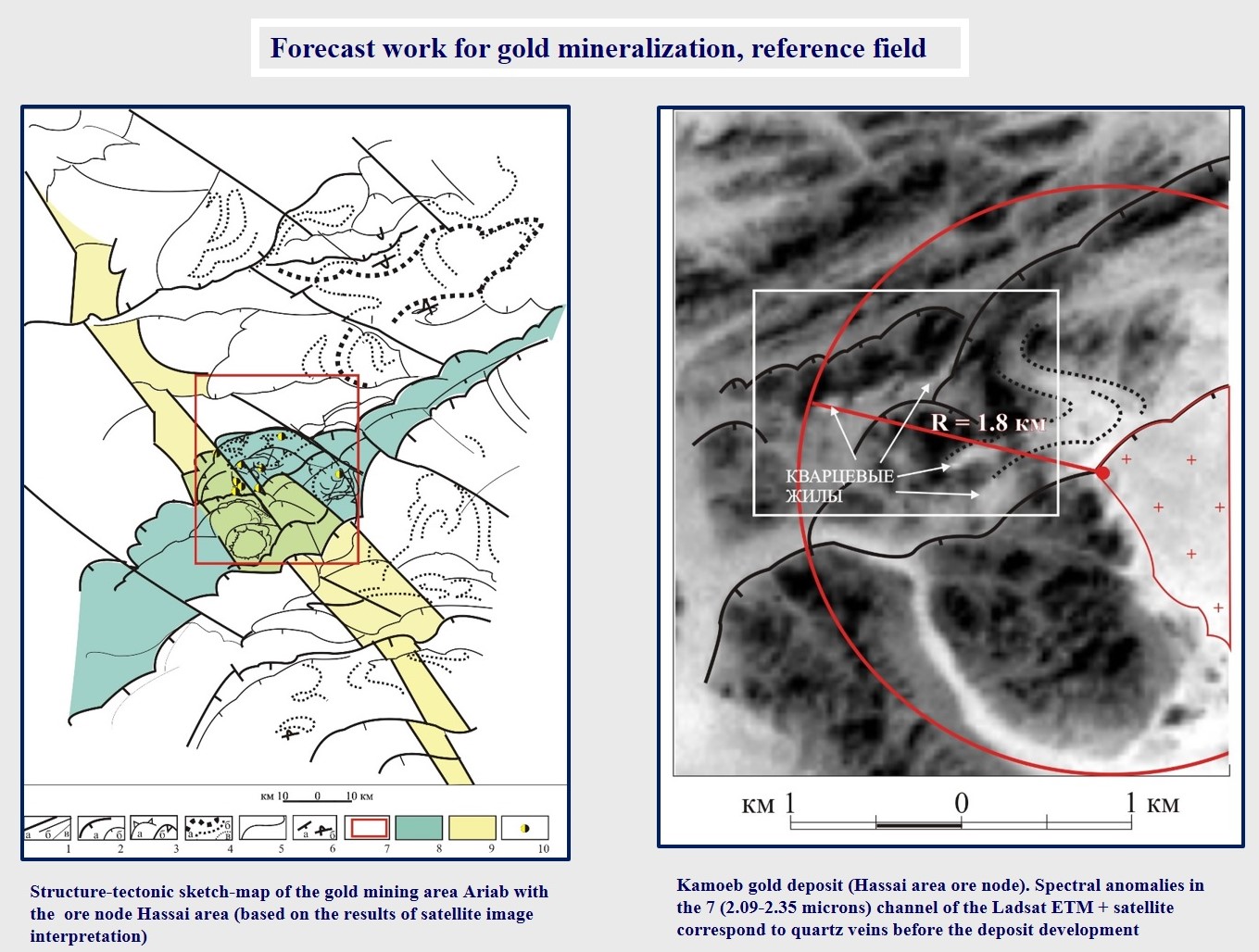
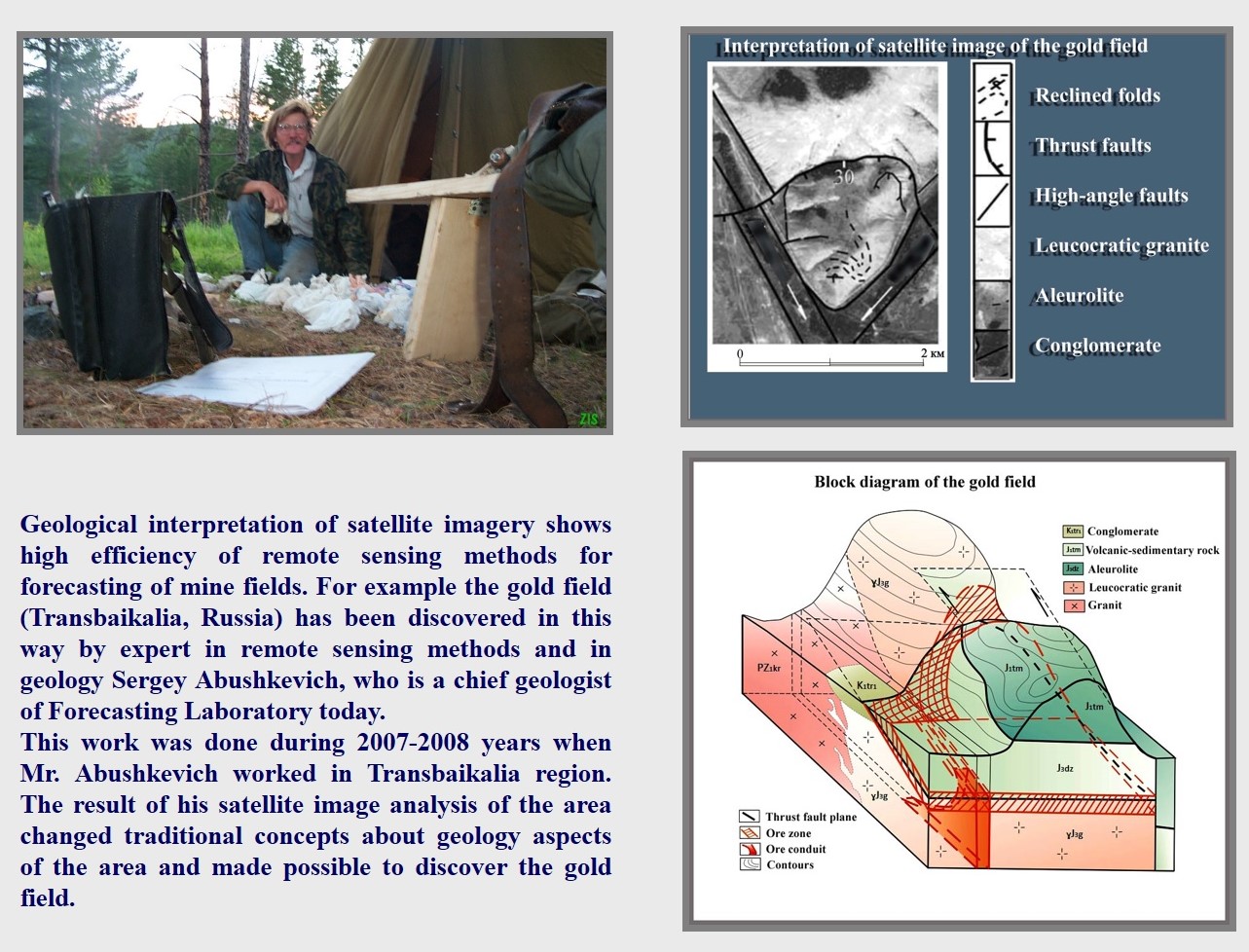
Our specialists have carried out numerous projects in various regions of Russia and abroad. As an example of successful work, one can cite the discovery of a gold ore deposit in Transbaikalia. The analysis of data from remote sensing of the Earth, carried out by S.A. Abushkevich showed a fundamentally new structural position of the ore body in the massif, which ultimately contributed to the discovery of the deposit.
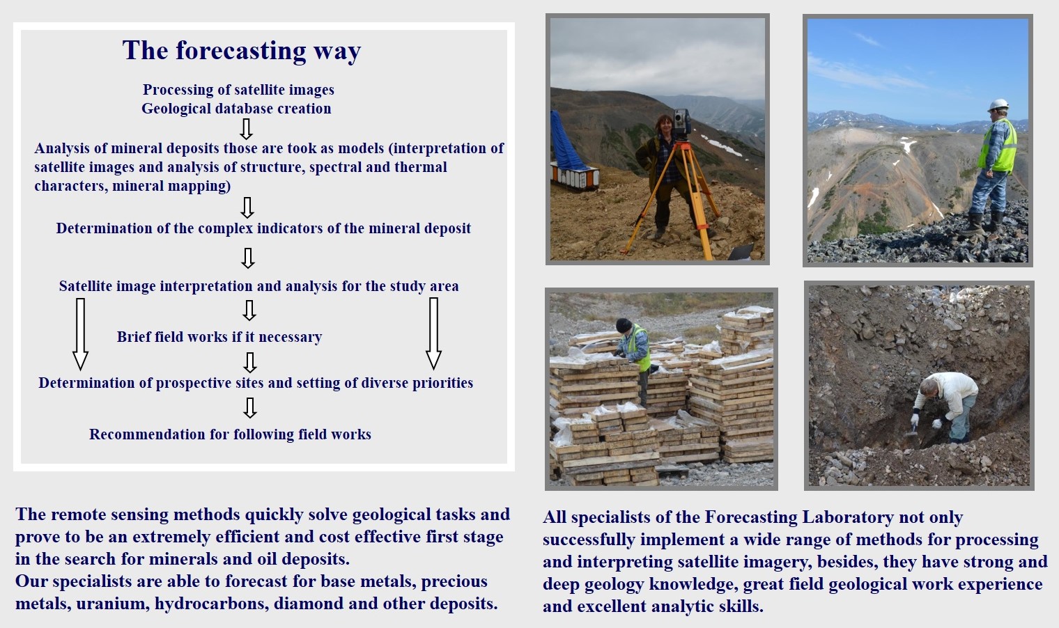
Each project implies its own necessary set of works, which is determined by the specifics of the task. There is a generalized research algorithm:
- creation of a database (both remote sensing data and geological and topographic data);
- processing of remote sensing materials (RSM) and production of factographic sattelite imagery based maps;
- satellite image interpretation within the work site, as well as reference objects;
- comprehensive analysis of interpretation results;
- determination of cosmogeological criteria of ore prospects for standard ore fields;
- identification of criteria of prospects within the work area and delineation of promising areas, ranked according to the degree of prospects.
These tasks include:
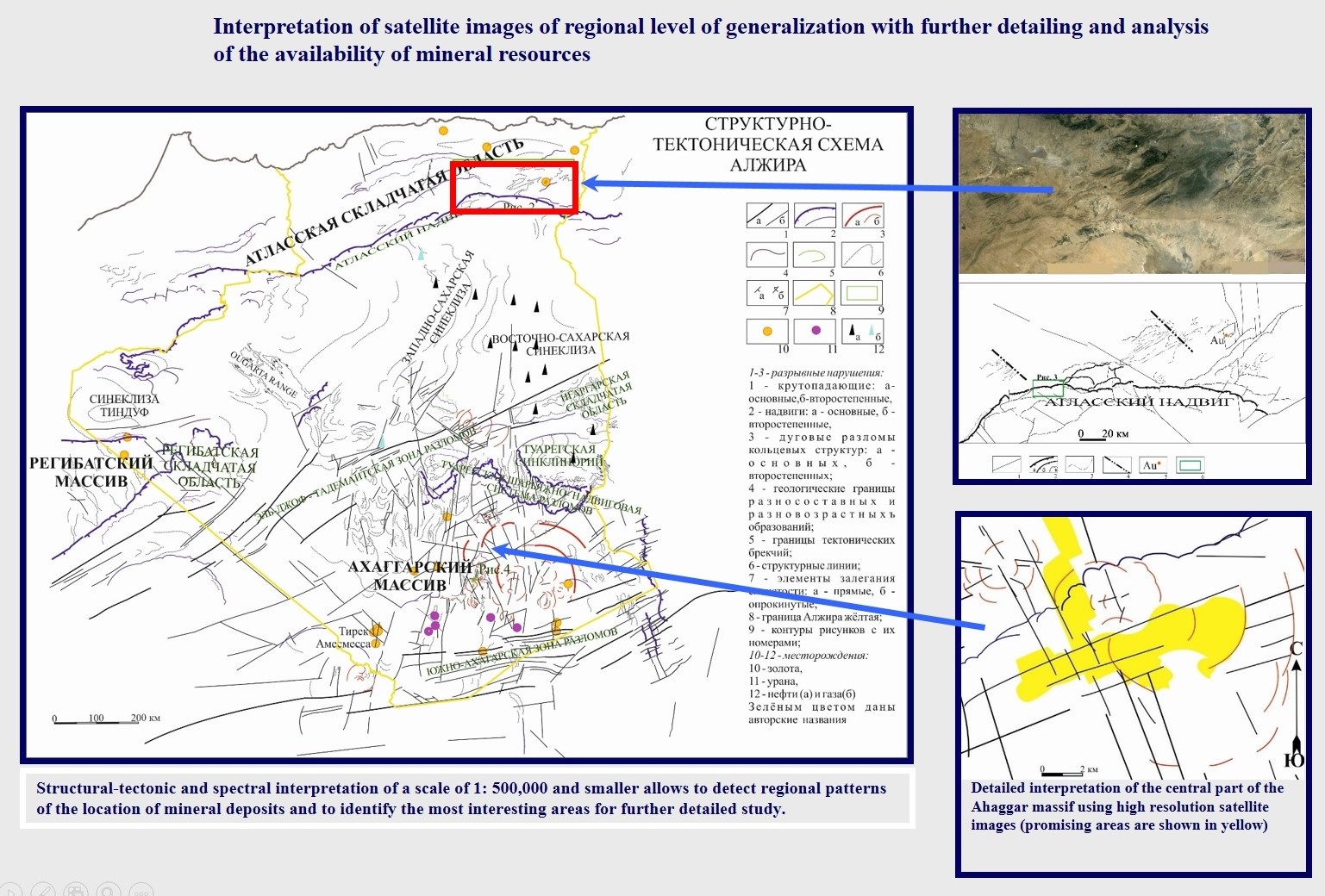
- structural and tectonic interpretation of the RSM;
- spectral analysis of RSM;
- geomorphological interpretation of RSM;
- lithological interpretation and mapping of RSM;
- building a digital elevation model;
- other types of work, based on a specific task.
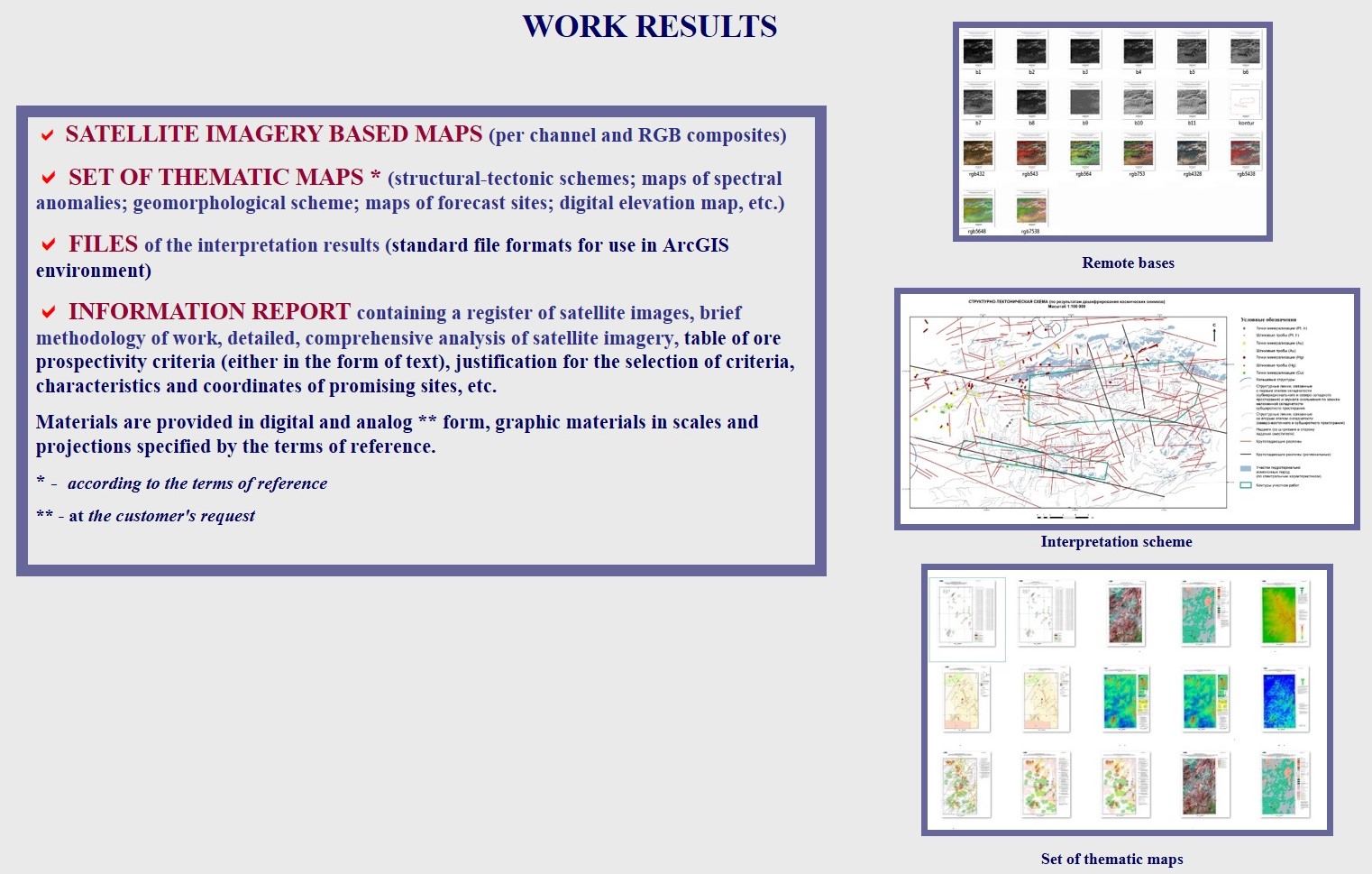
Based on the results obtained, the following are created:
- contour maps of the terrain;
- structure-tectonic sketch-maps;
- maps of spectral anomalies;
- digital elevation model;
- geomorphological maps;
- lithological sketch-maps;
- layouts of ore promising sites;
- other thematic maps and diagrams, the set of which is determined by the specific objectives of each project.