Structure-tectonic interpretation
Structural-tectonic interpretation of remote sensing data (RSD) – alpha and omega of remote forecasting works.
Interpretation is always carried out simultaneously by several specialists, independently of each other, in order to minimize the factor of subjectivity.
The interpretation results are combined, identical elements are left on the resulting structural-tectonic sketch-map, non-coinciding elements are discussed collectively and, if they do not find a rational explanation, are removed from the final scheme. The interpretation structural-tectonic sketch-map is compared with topographic maps, and the elements that coincide with anthropogenic objects are excluded from the sketch-map.
The detail and variety of components of structural-tectonic interpretation depend on the quality of the remote sensing data (RSD), the scale of work, landscape features of the territory, landforms, density of vegetation cover, climate, the degree of anthropogenic interference in the natural landscape and other factors that determine the clarity of the display of surface elements and affect the possibilities of interpretation.
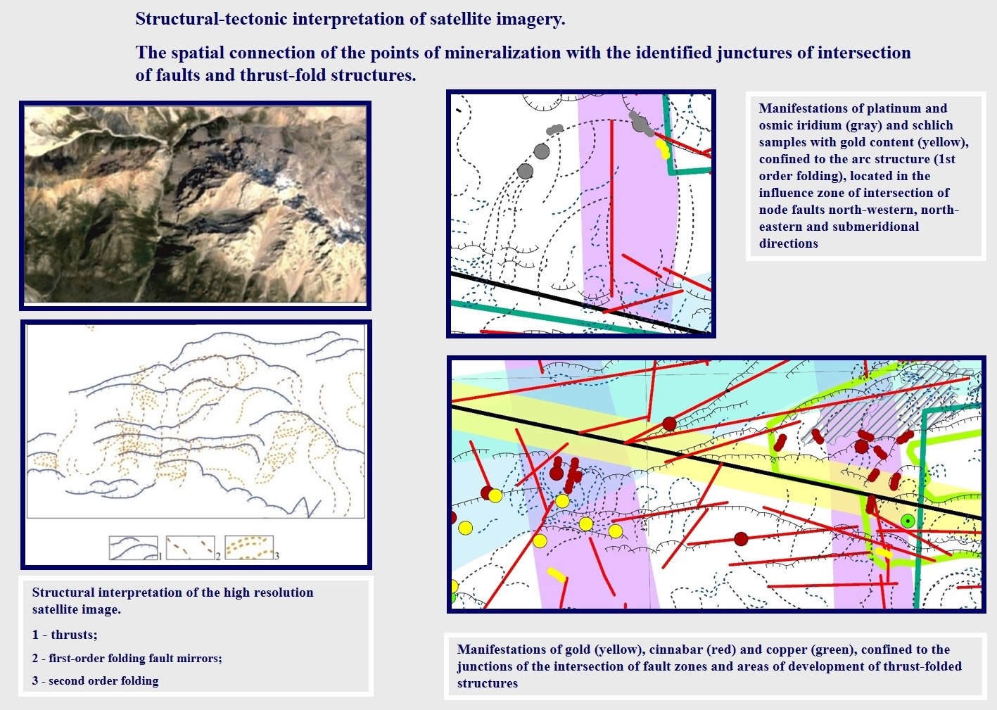
In the process of structural-tectonic interpretation, the following are revealed:
- steeply dipping linear discontinuities,
- gently dipping faults (thrusts),
- folding and fold-thrust systems,
- strike and dip of rock layers (only when using high resolution RSD)
- arc and ring structures
- fault systems
- generalized morphostructural elements (morphostructural blocks)
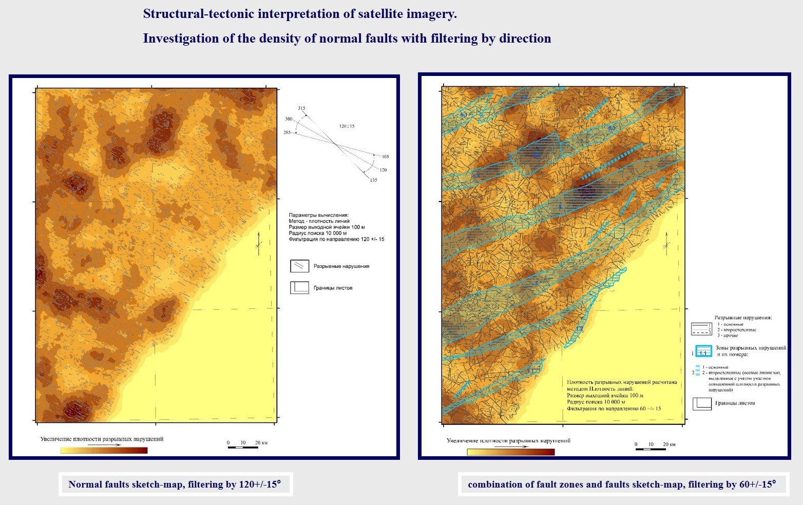
- other strucral features of the territoryAfter the decryption is completed, a statistical analysis of its results is carried out: the calculation of density characteristics by several parameters, the construction of a rose diagram of ruptures, and others. The types of processing of the decryption results are dictated by the tasks and characteristics of each specific project. Often such studies go beyond the scope of the technical assignment, since their necessity becomes clear only in the course of work.
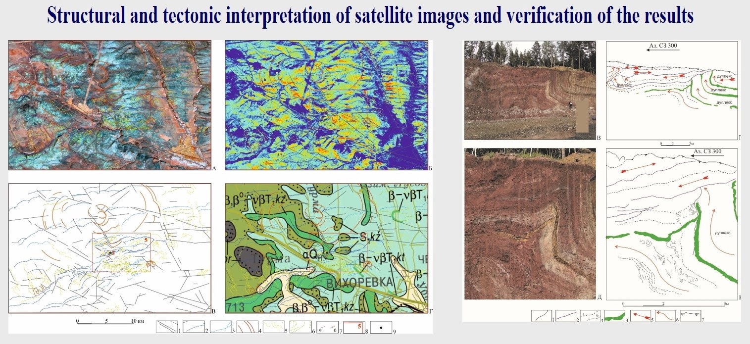
The reliability of our structural-tectonic interpretation was repeatedly confirmed in the course of subsequent field work by reconnaissance routes, geophysical data, and drilling.
Upon completion of the structural-tectonic interpretation, structural-tectonic diagrams, diagrams of densities and systems of faults, and other thematic maps and diagrams are constructed.