Spectral analysis and lithology
Spectral analysis of remote sensing materials and lithological interpretation of the remote sensing data (RSD) are an additional source of information for identifying potentially promising areas.
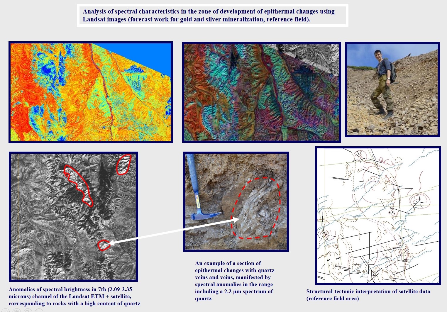
Spectral analysis of RSD
Modern methods make it possible to use multispectral and hyperspectral satellite imagery data to detect spectral and thermal anomalies in certain spectral zones, which suggests the possible presence of certain mineral complexes in these areas, indirectly indicating the ore potential.
Best of all, the spectral analysis method works for open areas of the arid, arctic and, in part, subarctic zones, where vegetation cover is poorly developed or completely absent.
For heavily forested areas (areas of rain forest development, taiga areas, deciduous forests, dense shrubbery, abundant herbaceous cover), spectral analysis can give incorrect results. This must be taken into account when interpreting the data of spectral analysis of such areas, or completely abandon this method when interpreting satellite images for forested areas.
The analysis of thermal anomalies is absolutely necessary in predictive work on the search for groundwater and thermal waters, as well as in the study of volcanically active regions (this is especially true for monitoring volcanic activity).
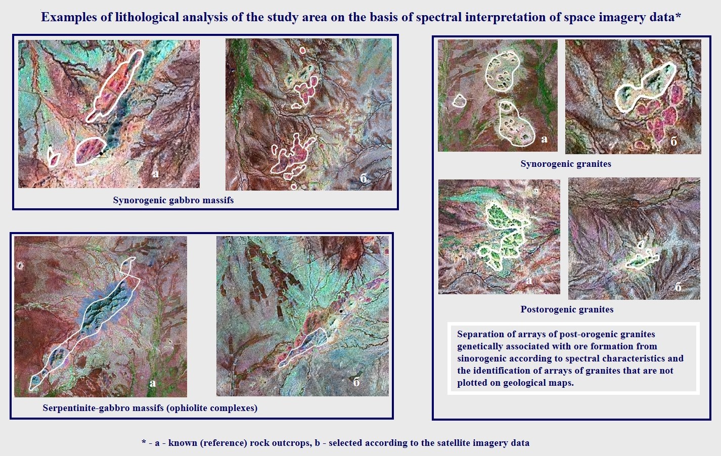
Lithological mapping
Lithological mapping based on RSD, as a rule, is an element of forecasting work in areas not covered with vegetation or with poorly developed vegetation.
Lithological mapping is important when detailed geological maps of the required scale are not available, and when the ore mineral is confined to certain rock massifs.
Usually, lithological analysis is local, aimed only at identifying and differentiating specific rock complexes.
Based on the experience of previous projects, such studies are often effective and carry important additional information that helps to identify the most interesting areas for searching for a mineral resource.