Geomorphology
Geomorphological interpretation of remote sensing data (RSD) and analysis of the results is an important, often obligatory, part of forecasting work and provides additional information about the structure, history of development and the genesis of the relief. These data are taken into account in a comprehensive analysis of the prospects of the territory.
Geomorphological interpretation can be partial, aimed at solving a local problem in the project. For example, the task is to analyze the paths of possible drift of sedimentary material from the summit surfaces (ridges, individual peaks), as well as the nature of the accumulations of material (eluvial, deluvial alluvial deposits), which may contain a useful component. This requires a narrowly focused interpretation of space survey materials and, based on the interpretation results, the construction of the following geomorphological maps and diagrams:
- Map of the thalweg erosional network (of various orders), as well as the boundaries of river catchments of the study area;
- Scheme of erosional dissection of the relief (horizontal and vertical), characterizing the depth and density of the erosional incision, which will make it possible to conduct productive schlich sampling of the alleged placers;
- Map of the slope steepness as the main characteristic of the rate of drift of sedimentary material from the top and accumulation of the carried material containing the useful component;
- Residual elevation (relief) map and demolition map (rock volume removed) showing the potential rock volume that can be removed in the future by denudation and erosion processes.
- The slope exposure map showing the direction of the slope of the main transport streams and a map of solar insolation of slopes as one of the factors of physical weathering;
- Scheme of intensity of erosional dissection;
- Diagrams of base and summit surfaces, differences in base surfaces allowing to analyze and highlight areas of the latest tectonic uplifts and subsidence;
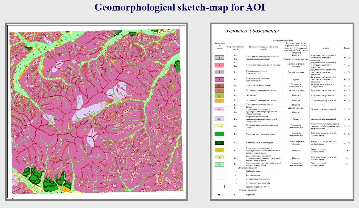
It is also possible, if there are high-quality resolution RSD and basic geological materials, a complete geomorphological interpretation with the compilation of a generally accepted geomorphological map. When compiling such geomorphological maps, State Requirements for Geomorphological Mapping are used.
The content of a geomorphological map is based on: genetically homogeneous relief surfaces, main geomorphological boundaries, wireframe relief elements, isohypses and isobaths. A detailed explanatory note is written to the map.
This work can be done as a standalone project, and also within the forecasting work.